Saturday, November 7, 2020

'Ere break of day - Beaufort NC to Wrightsville Beach, NC

'Ere break of day - Beaufort NC to Wrightsville Beach, NC

Saturday 7th Nobember 2020

The end of my journey with Mike & Gloria is for me to fly home from Wilmington, NC which has an airport with decent connections to Providence. Careful readers of this blog from 2018 will remember that the three of us flew back to RI from Wilmington after returning to the US from the Bahamas.

That year, we sailed up the Cape Fear River and stayed in Wilmington.  This year, it's more practical for me to get to the airport from Wrightsville Beach.  Getting here from Beaufort requires a choice.  One can use the ICW, this stretch of which is shallow and difficult to traverse or go offshore, directly to Wrightsville Beach.  The offshore route is about 63 miles.

Looking at the weather forecast calling for NE winds 10-15 with gusts to 25, we decided that the offshore route would be doable, especially with an extra person on board.

The only issue was 63 miles at 5 knots is 12 hours.  Our choices:  Leave in the dark, or arrive in the dark.  We chose to leave in the dark at 5 AM hence the start of this post.

Awakening at 4:30 AM, we grabbed a cup of coffee, cleverly prepared the night before, piled on several layers of clothes and pulled up the anchor.  Motoring through the myriad of lighted buoys was made much easier as Mike took us through some of the outbound route yesterday.  This gave us a GPS track to follow in the dark.

Just before leaving the harbor, we hoisted the mainsail.  Once clear of the harbor, we unfurled the genoa and were able to make about 6.5 kts on a broad reach (that means the wind is almost, but not quite directly behind the boat).  The wind, as predicted, was out of the NE at about 12-14 knots. We shut down the engine.  The seas were a bit rolly, but tolerable.   A slight starboard turn ( that's a right hand turn for you non mariners) put this wind almost directly behind us so, with excellent work on the foredeck by Mike, we poled out the Genny and sailed wing on wing for the next 50 or so miles.

 Mike finally got to try his vane steering device again.  This is a device attached to the back of the boat that senses the wind direction and steers the boat automatically.  These devices can be a bit finicky, depending on the sea state and the wind direction, but today, it worked brilliantly.  We had it steer the boat for us for over 3 hours instead of using the autopilot, saving battery power.  The rest of the time we used the auto pilot or steered by hand.

Several times we gybed the main sail as our direct course was almost straight downwind and that was neither fast not comfortable.  We expected cloudy skies and maybe a shower, but what we got we're sunny skies and glorious sun.  Layer after layer of warm clothing came off until Mike and I were in tee shirts and shorts!

Because of decent cell phone reception, we were delighted to learn, around midday, of Joe Biden victory.  Cheers all around!

After sailing for 11 1/2 hours, we arrived off the breakwater at Wrightsville Beach at 4:30 pm.  Dowsing the sails, we anchored in the northern end of the harbor and, having made the Cotinga "trig", we enjoyed a well deserved sundown cocktail followed by a dinner of pulled pork tacos with ratatouille made the night before.  A hot shower completed the evening and my eyelids are barely staying up as I complete this post.

Tomorrow, we explore Wrightsville Beach.

Rod

34 12.383 N, 77 48.020 W
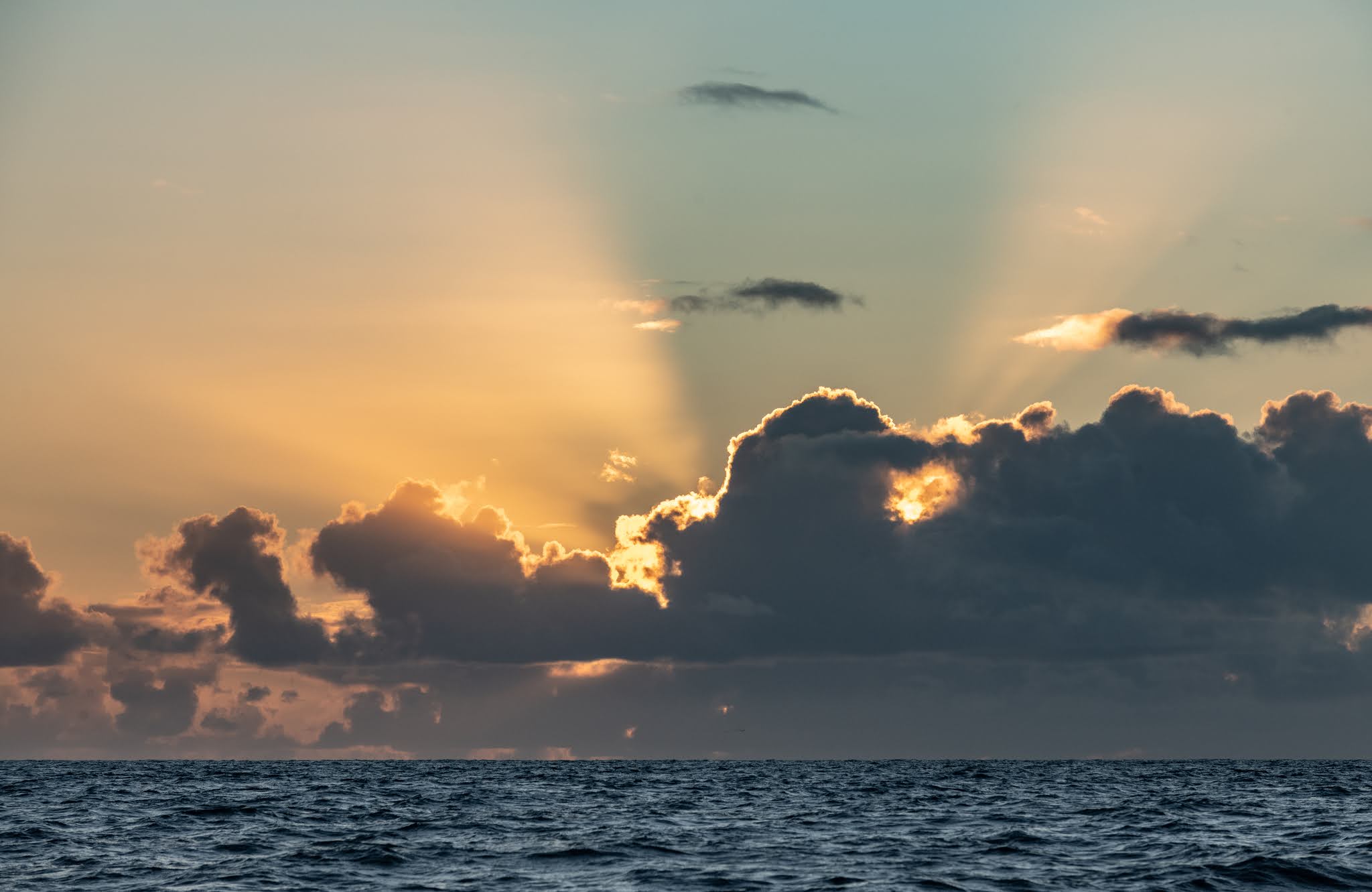


Sunrise off Beaufort


Downwind sailing Beaufort - Wrightsville Beach


Downwind sailing Beaufort - Wrightsville Beach - "Wing on Wing"


Friday, November 6, 2020

Beaufort, NC

Beaufort, NC

Friday 6th November 2020

By necessity this post will be brief. We are anchored in Taylor Creek off the waterfront in Beaufort, NC and are preparing to head offshore early tomorrow morning to sail south to Wrightsville Beach, NC, so we have a few jobs to do and need to get to bed early for a 5am departure tomorrow.

Today we left the tranquil anchorage off the Neuse River and motored down through Adams Creek and canal to the marshy waterways north of Beaufort and onwards through the often changing channels to the town itself. It wasn’t a particularly long journey but it seemed to take forever. There was quite a lot of boat traffic including numerous barges and power boats. The currents were against us so that we were only making 5 knots over the ground despite doing close to 7 knots through the water. Then there are complex channel systems and numerous shallow spots due to constant silting that need to be negotiated. Last but not least, the anchorage is quite narrow and fairly crowded, and we had to select a position quite carefully that was just out of the channel but still deep enough. As it is we have just 12 inches of water under our keel at low tide.

We did manage to dinghy ashore this afternoon and had a pleasant walk around town. Beaufort has a number of good restaurants but the only grocery store seems quite a distance from the center of town, so we didn’t bother with that. After returning to Cotinga we pulled up the dinghy, deflated it and tied it down on the deck. We tightened up the temporary lifeline and prepared the self-steering system. Then it was time to cook dinner for tonight (pork chops, mashed sweet potato and green beans) and also some ratatouille to eat whist underway tomorrow.

We’ll let you know how the offshore passage goes in our next blog!

Mike

34 42.872 N, 76 39.915  W


Fishing boats, Beaufort, NC


A "Dragger" returning to port


Cool door - Beaufort, NC


Butterfly and flower, Beaufort, NC


Azalea


Thursday, November 5, 2020

Post Election Anxiety

Post Election Anxiety

Thursday November 5, 2020

Three years ago, this was the date that Mike, Rod, Dave and Brian set off from Norfolk on the Caribbean 1500 rally.  It’s also Guy Fawkes Day—a (sort of) holiday in the UK to memorialize the attempt to blow up the British parliament. It seems like a strange thing to celebrate with a holiday but....we may start to be able to see why that might be something to celebrate. (Mike: I think it actually celebrates the execution of Guy Fawkes, the leader of the “Gun-powder Plot” to blow up the House of Parliament. There are bonfires to represent his burning at the stake and fireworks to represent the gunpowder … it still seems a little gruesome)

On Cotinga we are all suffering, to some degree, with post election anxiety (PEA).  I imagine that all across the nation there are many others who have symptoms of this disorder.  We seem to have different strategies for coping with the lack of information.  I’m trying to ignore my PEA and focus on the landscapes and seascapes that present themselves as we make our way along the ICW.  Rod seems to check his phone a lot. (On Tuesday night we had no cell phone reception so we were really in a news black-out. Thankfully, Sue sent some information by text—not that it was the news for which we had been hoping).  Mike alternates between checking his phone and nervous eating. (According to CNN this is a nationwide phenomenon) Then every so often we start speculating on how did the election come to this, what does it mean for our nation, what will we do next, etc.  Then I need to go find the jar of chewable antacids. Maybe my coping strategy isn’t working out so well!

This morning we had a slow start with a delicious blueberry pancake breakfast.  By 8:30 am the anchor was up and we were underway.  After a short while we unrolled the genoa and motor-sailed down the Pungo River.  When the wind faded away or came from an unfavorable direction we furled the sail.  We made about 45 statue miles in six and a half hours.  We are now anchored in the South River, which leads off the Neuse River.  Approximately on the opposite bank of the Neuse River lies Broad Creek, scene of two of our earlier boating adventures.  The first was at the River Dunes Marina where we waited out Hurricane Sandy in October of 2012 (and made great friends).  The second was a intense night-time thunderstorm during which we believe we were dragging our anchor and set about re-anchoring as lightening was flashing all around and the rain was hammering down.  

Gloria

34 58.233 N, 76 34.847 W


First light in Belhaven, NC


The yacht "Journey" in the Belhaven anchorage at sunrise


Reflections of sunrise


Wednesday, November 4, 2020

Where are we going?

Where are we going?

Wednesday 4th November 2020

There are so many ways to interpret the question “where are we going?” I might be referring to tomorrow’s journey, our destination for the winter or the future of this country. At this point I’d have to say that I don’t have any idea for any of these, but I expect that we’ll figure out somewhere to go to tomorrow. I have much less confidence in the two broader questions.

Today we continued on our way from Portsmouth, VA to Wilmington, NC from where Rod is planning to fly home. We woke to a perfect morning in our anchorage at the south end of the Alligator River – a cloudless blue sky, a little mist of the water and complete tranquility. This seemed at complete odds with the turmoil we were feeling about the elections. Nonetheless, we had a lovely motor down the Pungo-Alligator canal with beautiful scenery and lots of wild life in the form of bald eagles, red shouldered hawks, kingfishers, black vultures and a family of four dear swimming across the canal. We arrived in Belhaven in the early afternoon and after a quick lunch went ashore to walk around this sleepy little town. In the past three days we have gone from wearing almost every item of clothing we own back to shorts and T-shirts. The contrast in temperature is amazing.

We still don’t know the outcome of the election but we are all horrified that almost half the voting population don’t care enough about truth, respect for others and basic human dignity that they vote for the evil scumbag. If this country is as polarized as it appears then maybe it is time for the Union of States to dissolve and each go it’s separate way. I for one am ashamed to be part of a country with values that are represented by the likes of Donald Trump.

Mike

35 31.871 N, 76 37.290 W


Sunrise on the Alligator River


Early morning at our anchorage on the Alligator river


"Tupolow Honey" heads down the Pungo-Alligator Canal in early morning fog


A large barge in the Pungo-Alligator Canal


Bald eagle flying over the Pungo-Alligator canal


Ripples on the water created by the wake of a passing boat


Motoring down the Pungo-Alligator canal ... the noise is partly the engine, but mostly the sound of the water rushing past the hull


Motoring down the Pungo-Alligator canal


Deer swimming across the Pungo-Alligator river

Coinjock to the Albemarle to the Alligator River

 Coinjock to the Albemarle to the Alligator River

Tuesday 3rd November 2020

Where do they get these names?  Here, at anchor off Tuckahoe Pt in the Alligator River, we have no cell phone service, which means ... no internet so we can't satisfy our curiosity regarding the origins of these names.

It also means that today's blog won't appear until tomorrow, Nov 4.  It also means we won't get any news about the election, either.  That's probably a good thing as drinking enough to stay calm would seriously deplete the liquor stores aboard.

In case you've noticed a change in style in this blog, it's because Gloria's brother Rod is writing this "episode".  

I actually joined them in Portsmouth, VA on Sunday, flying into Norfolk from RI.  

Ever since I caught the sailing bug back in 1983, the idea of traversing some or all of the Intracoastal Waterway has been in the back of my mind.  While discussing their trip south, Mike and Gloria invited me to join them for part of the trip, which explains why I am writing this blog from this place.

Picking up the thread from the last post (which I couldn't finish as the cell service just dropped out again), we awoke to some pretty chilly temps this AM in Coinjock.  We were tied up alongside the quay at the marina, sort of like cars are parked at the curb, and probably closer together.  The early departure of many other large powerboats, with bow and stern thrusters, left us space to get Cotinga off the quay with a lot less stress than yesterday's docking.  

Today's leg was just a bit over 50 miles, but in much more comfortable conditions.  The Gusty winds of yesterday had subsided to 12-15 kts out of the West.  

The first 15 miles or so of the leg were under motor as we were still in a narrow "cut" without room to maneuver.  Once we finished this section, we entered the Albemarle Sound with plenty of room to sail.  Hoisting mainsail and unfurling the genoa, we took off like a bat out of hell on a close to beam reach on a W to WNW breeze of 12-15 kts.  Cotinga fairly flew over the next 12 miles.  The knot-meter never went below 8 knots and occasionally hit 9 knots.  Mike let me hog the wheel for the entire time!  The sun was shining, not a cloud in the sky and & we actually started warming up.  Considering that I never expected to be able to sail at all, this was glorious.

All too soon, we had to cross through the Alligator River turnbridge and needed to take in the sails.  Inasmuch as the wind started to drop to 4-6 knots, this worked out fine.

Another 15 miles or so got us to our current location, anchored in 10 feet of water off Tuckahoe Pt.  It is really quiet and lovely here with no signs of civilization and only one other boat in this anchorage.

Rod


Sunset at the south end of the Alligator River


The bow pulpit at sunset


Rod Breault Photo: this awesome abstract shot that Rod took is of the towing bridle on the dinghy


Looking towards the ICW that we would motor down the following day


Sunset from our anchorage at the south end of the Alligator River


Sunset from our anchorage at the south end of the Alligator River


The "Dumb Dog" hanging off the stern in the remote Alligator River anchorage


Monday, November 2, 2020

What a Start!

What a Start!

Monday November 2nd 2020

We woke early and everyone found the weather a bit chilly.  Some had even been cold while still in bed!  A few chores had to be taken care of before departure.  We pumped out the rain-water from the dinghy, took the trash up to the marina and disconnected the shore power cable.  Then we set off from the dock with some fancy maneuvers to keep us close to the dock and away from the pilings on the other side despite the wind coming diagonally across the bow.  The area around Norfolk is very industrial with many Navy installations and many other docks, cranes, conveyor belts and storage silos.

The first obstacle to the trip was a road bridge at mile 5.8 that opened on the half hour.  There were four powerboats and two sailboats (including ours) circling around waiting for the bridge to open at 8:30 am.  Then came the Great Bridge Lock and Bridge combo.  The lock operators announced that it would be a starboard tie up and no fenders would be needed.  When we got to the lock gates, they announced that the two sailboats would have to do a port tie up.  What wasn’t mentioned was that there were no rubber bumpers on the left side.  Let’s just say that the tie-up in the lock didn’t really go ideally.  After the water level was let down 1.5 feet the dock gates opened and the boats filed out only to wait for the bridge to open.  We needed to stay more or less stationary despite the gusty 20-25 mph wind.  Nerve wracking!  Two more opening bridges and we were done with those obstacles.

The rest of the day was less eventful—but windy and cold.  We saw 35 knots on the wind instrument.  Much of the afternoon the wind speed stayed over 20 knots fairly consistently.

We did hear some boaters claiming that there is no ‘bad weather’, just poor clothing choices. During the day we all had to make some adjustments to our clothing choices. By the end I was wearing long underwear, wind resistant pants and foul weather bibs.  On my top half I had a T-shirt, a fleece top, a hoodie, a fleece jacket and my foul weather jacket.  Along with my fleece hat, hiking sock and gloves I was just about warm enough. Staying warm on the boat is not a trivial matter.  With any luck, it won’t be nearly so windy tomorrow.  

Now we are tied up at Coinjock Marina along a face dock.  Captain Mike executed a spectacular docking into what the marina staff claimed was a 60ft gap in a long row of large powerboats.  Essentially what was required was a parallel parking maneuver with out the benefit of any brakes.  Somehow he managed this.  I’d say it was a stroke of genius.

Gloria

36 20.969 N 75 56.903 W


Once clear of the industrial side of Norfolk, the Virginia Cut leg of the ICW is quite pretty. We saw at least 6 bald eagles


The "Dumb Dog" trailing behind in the Virginia Cut section of the ICW


The North Landing River was the most open section of water and coincidentally where the winds peaked at 35 knots and were sustained above 25 knots for more than an hour. It was quite choppy, but mostly  from the stern


Tied up to the face-dock at Coinjock marina. 


It was a tight fit to squeeze into the space available.


Sunday, November 1, 2020

Rod Arrives in Portsmouth, VA

Rod Arrives in Portsmouth, VA

Sunday 1st November 2020

Rod had a really early start this morning – up at 4.30 am to catch a flight out of Providence to Baltimore and then on to Norfolk. His travels went well and shortly before 11 am he arrived at the dock in Portsmouth. He was quickly pressed into service helping to fill the water tanks and tidy the cockpit, just before it started thrashing down rain. Fortunately it cleared up shortly after lunch and we were able to take a walk around town. I’ve grown to like Portsmouth – it’s got a fine waterfront with views across the Elizabeth River to Norfolk and some of the naval shipyards and the downtown area has many good restaurants and pubs. This afternoon we wandered around the older residential part of the city with attractive historic houses, trees and gardens. As you get away from the center of town the area seems a lot less affluent and more run-down. However, when I bicycled out to refill a second propane tank this morning, I saw two things that gave me a sense of the strong community of the area. Firstly there was a church service taking place in the parking lot of a neighborhood church. A stage and sound system were set up with three people singing gospel music to the congregation who were gathered in their cars. It was quite moving. The second event was being lead by a group of Hells Angels gathered in front of a supermarket. They were running a food collection for local people in need. I got talking to a couple of the bikers, who couldn’t have been more pleasant and offered to keep an eye on my bike when I went in to shop.  To be honest it wasn’t really what I expected.

Tomorrow marks the first day that our boat insurance will allow us to go further south than Norfolk and so we will start our journey down the Inter Coastal Waterway (ICW). Apparently they view the hurricane risk as much diminished … even as Eta forms in the Caribbean!

Mike

36 49.891 N, 76 17.764 W


Flowers photographed in the Olde Towne residential neighborhood of Portsmouth


Ditto


Ditto