Saturday, November 14, 2020

Road to Nowhere

Road to Nowhere

Saturday 14th November 2020

This afternoon we got chatting with a couple called James and Amanda on a sailboat anchored close by. They too are heading south and like us their plans are in turmoil because of Covid. After the conversation I thought about the Talking Heads track “Road to Nowhere” and realized that it fits our current situation perfectly. (fyi Talking Heads are one of my favorite bands of all time). As time goes by it seems increasingly unlikely that we will be heading down to the Caribbean this winter or even over to the Bahamas. So we are making a deliberate effort to change our approach. Rather than rushing to get down to Florida we are now trying to slow down and focus on enjoying where we are. This is a bit of a challenge for me as I’m always in a rush, thinking ahead and planning the next step, but I think this will be a good experience for us. 

There are some practical advantages to a more leisurely pace and in particular, we can do shorter journeys on any given day and schedule them to make use of high tides to avoid issues with shallow sections in the ICW. Today we got up at 5am and left an hour later in the dark. Yes, I know that doesn’t sound very leisurely, but it allowed us to cross the Lockwood’s Folly inlet and Shallotte River inlet at close to high tide with an extra 5-6 feet of water under our keel. Both of these areas are notorious for shoaling and vessels running aground. Once past these obstacles we carried on for a few more miles and then turned into the Calabash Creek and anchored. The entrance to the creek has a sandbar that is reported to be close to 5 ft depth with extreme low tide, but we came in at mid-tide and never saw less than 9 feet. By 10 am we were anchored safely in the creek with the rest of the day ahead of us. 

It’s beautiful here with fast flowing muddy water, marshes and wooded skylines. We saw so many birds today, literally dozens of kingfishers, blue herons, tricolor herons, pelicans, egrets and ibis to name a few. Shortly after anchoring a bald eagle flew right over the boat and landed in the trees close by. We heard it calling to its mate and then spotted the partner close by. It was quite magical. We took a brief dinghy trip up to the town of Calabash about a mile away. It’s a small, touristy town with many restaurants overlooking the creek. There is an active fishing / shrimping fleet as well as several charter boats primarily for fishing trips. It was fun to walk around and we bought some shrimp on the dock that we plan to eat this evening. 

We could have gone further today and made it to the Waccamaw River but then we wouldn’t have experienced Calabash. Also we would have had to tackle another challenging area called the “Rockpile” at low tide. By stopping here until tomorrow we get to go through that 4-mile section at high tide. We’ll see how it goes in the morning!

p.s. The army corp of engineers publish their latest hydrograph survey data for some of the areas that tend to be prone to shoaling. Here is the link to the Calabash Creek map which might give you some idea of the challenges we are dealing with.

https://www.sac.usace.army.mil/Portals/43/docs/navigation/hm/IC_02_CBC_20200113_CS.pdf?ver=2020-01-21-154425-303

Mike

33 52.352 N, 78 34.196 W


Cotinga anchored in Calabash Creek .... 8-14 ft depth here, up to 2 knots current


This is where we bought our fresh shrimp in Calabash


Juvenile laughing gull


It's unfortunately quite common to see wrecked boats in this part of the USA as a consequence of the tropical storms / hurricanes that come through on a regular basis. This boat is one of three washed up in the anchorage in calabash Creek


This is a shrimp boat that stopped right next to the anchorage to sort out the nets and gear. Although well lit it was a trial for my photo equipment. The tripod holds teh camera steady but doesn't stop the boats moving so this was shot at ISO 3200, F2.8, 1/10 sec


Abstract shot with lens rotated part-way through a longer exposure


Friday, November 13, 2020

“She –Lowe’s”

“She –Lowe’s”

Friday November 13, 2020

We will get to the She-Lowe’s in a minute...

We left Carolina Beach at about 8:30 this morning.  When we entered Snow’s Cut our speed declined from 6 knots to nearly 4 knots as a result of opposing current.  In contrast, once we got out into the Cape Fear River, we had current pushing us along at speeds of 9 to 10 knots.  We also got to enjoy plenty of LARGE BOAT traffic—yikes.  We re-joined the ICW at Southport and motored along to the St. James Marina.  When we called on the radio about coming into the fuel dock, we were told that the fuel dock was occupied and we would have to ”wait” in the ICW.  This involved slowing down and then making U-turns in the waterway until we got the radio call that the fuel dock would soon be available. Our instructions were to proceed into the marina and “hang” at the end of G dock.  We no sooner got tied to G dock then we were instructed to move to the fuel dock.  Skillful driving by the captain got us off G and onto the Fuel dock.  We were able to fill with diesel and pump out simultaneously thanks to the help of Jason (a Coast Guard retiree who had worked on a buoy tender in Rockland, ME).  Then we had to move over to our slip—back to G dock.  The captain managed to back the boat into the slip beautifully.

Before we left Carolina Beach this morning, Mike remembered that our friends Jeff and Kim had bought a house in the St. James Marina complex.  (Jeff was Mike’s boss at Astra Zeneca for most of the time that we worked at the Waltham site in Massachusetts.) He e-mailed Jeff who was unfortunately away in Maine on a hunting trip, but happily Kim was at home and she very kindly came down to the dock to meet us in the afternoon. She took us to their house and gave us a tour of her studio where she does amazing stained glass art-work … fascinating! Afterward we went out to the “Frying Pan” restaurant in Southport for dinner (so called because it’s a fish restaurant and is named after the Frying Pan shoals off Cape Fear).  On the way back to the marina we stopped into a grocery store for a few items.

The grocery was called Lowe’s.  Kim informed us that locally it’s referred to as “She-Lowes” to distinguish it from the DIY place “He-Lowe’s”.  Once inside, I started to question this distinction, however.  She-Lowe’s has a beer den—a bar serving beer and wine to the husbands who can sit and drink while the little woman does the grocery shopping.  Is that a She-Lowe’s or another (and perhaps better) He-Lowe’s?  What a concept!  

Gloria

33 55.584 N, 78 07.587 W


Container ship "Faustina" in the Cape Fear River ... we stayed well clear just outside of the shipping channel


Similarly, the container ship "Andromeda" in the Cape Fear River


Dredging operations in the Cape Fear River ... silting up of these waterways is a huge issue


Thursday, November 12, 2020

The joys of marine plumbing

The joys of marine plumbing

Thursday 12th Nov 2020

We didn’t have a lot planned for today, which is just as well. Shortly after breakfast I was pumping out the forward head (toilet) when it stopped emptying and I couldn’t pump any more. We only use the forward head to pee in and we have it set to pump directly overboard. I wasn’t totally surprised that there was an issue as we’ve been struggling to keep this unit smelling fresh in the past couple of weeks. I decided to disconnect the hoses and approach the problem from the out-flow side rather than dismantling the pumping unit. I found several sections of hose and the anti-syphoning u-bend to be almost completely constricted. What happens is that urine and seawater when mixed result in deposition of some insoluble salts and these build up in the hoses and the diameter of the opening shrinks from 2 inches to less than a quarter inch in this case. (As chemists we are interested in the basis of this.  We think the solids are ammonium magnesium phosphate hexa-hydrate, the ammonia comes from breakdown of urea, phosphate from the urine and magnesium from the seawater. It’s a problem in waste-water plants and in cats and dogs the deposits cause kidney stones.) If this were a blocked artery doctors would perform balloon angioplasty and put in a stent. The marine hose equivalent is a bit more basic. Having disconnected the hoses I jumped in the dinghy and went to the dock where I was able to pound the hoses against a wooden piling. We learned this trick from some fellow boaters a few years ago and it is a strangely satisfying experience. The deposits, which have the appearance and consistency of poor quality cement, come flying out of the end of the hose! All in all it took me a couple of hours to complete the project and the head now works like a charm ... and seems to smell better!

The other boat issue that we hoped to resolve today was our auxiliary microphone for the VHF radio. The “Commander Mic” as it is known … or “Commander Mike” as I like to think of it. Yesterday we were trying to talk with another boat whilst traveling along the ICW and they couldn’t here us clearly until we switched to our back-up hand-held radio. It turns out we have interference on our radio when (and only when) we use the cockpit microphone with the engine running. It is likely due to interference from the alternator. We don’t think this has always been a problem because we have used the “Commander Mic” extensively in the past, but we don’t know what has changed or how to fix it. Any advice would be very welcome.

As if all that weren’t enough excitement for the day, the predicted storms finally rolled in about 3pm with winds gusting to 40 knots and some of the heaviest rain we have ever seen. It’s reassuring to be on a large mooring, but we would have been smart to take the engine off the dinghy before the storm. At one point I got really worried the dinghy might flip and immerse the outboard in salt water. It didn’t and we were able to get the engine back on Cotinga once things eased up. It’s going to take a long time to pump the rain water out tomorrow morning!

There is only one thing to do on a night like this … eat smoked shoulder of ham and watch movies! I'm already in my PJs, having gotten soaked sorting out the dinghy, and it's only 5pm. 

Mike

34 02.727 N, 77 53.386 W


The mooring field behind Carolina Beach. The 8-moorings can be booked on line and cost $20 a night ... more expensive than anchoring, but reassuring when there are strong storms forecast.


Looking across the anchorage during the storm


The view from the stern once things started to settle


Wednesday, November 11, 2020

On behalf of a grateful nation . . .

On behalf of a grateful nation . . .

Wednesday November 11, 2020

It’s Veterans Day today.  On this day we are reminded of all those who have served our nation in the armed forces.  It strikes me that so many of the 16 million men and women who served in the Second World War have now passed away.  According to the department of Veterans Affairs only 325,574 veterans from WWII were alive in 2020.   Most of these people would be in their mid 90s.  Let’s hope that even when the last of these veterans has passed away, we still remember to be thankful for their sacrifice. (Vietnam veterans numbered 2.7 million with about 774,00 still surviving)

Before it started to rain today, I did some work on polishing the stainless steel.  There is still so much more that needs attention though.  I didn’t even finish down the port side of Cotinga.  It looks like the next few days are going to be quite rainy.  Progress on the stainless polishing is likely to be pretty slow.

After the band of showers passed through, we set off from Wrightsville Beach.   We motored southward beyond the Masonboro Inlet and into the ICW toward Snow’s cut.  Then at Snow’s cut we turned off to the town of Carolina Beach.  Mike had made a reservation for a mooring for two nights.  This should get us through the upcoming rain/thunderstorms and then we hope to set off again down the ICW. 

The geography of this area is complicated with Cape Fear separating the Cape Fear River to the south-west and numerous inlets to the north-east. Currents and tides are strong and highly variable depending on specific locations. The waterways are constantly shoaling and so it is good to make progress through some of the shallower sections on a rising tide. Although it was only a short ride today to Carolina Beach it sets us up well to go through Snow’s Cut and down the Cape Rear River on Friday.

Gloria

34 02.727 N, 77 53.386 W


This picture was created from a photo that I took last night of the fishing pier at Wrightsville Beach reflected in 4-fold symmetry and then converted to its negative. By the time I had finished editing the file in Photoshop it exceeded the 2 GB limit and couldn't be saved until I had slimmed it down!


Tonight's dinner - chicken piccata, spaghetti and broccoli - yummy!


Tuesday, November 10, 2020

Rod flies back to Rhode Island

Rod flies back to Rhode Island

Tuesday 10th November 2020

We were sad to see Rod depart this afternoon. It’s been great having him stay with us and travel down the coast over the past week or so. We managed one last walk on the beach in the late morning and a quick lunch from a local sandwich shop and then it was time for Rod to jump in his Lyft car and head out to Wilmington airport.

Amongst other things we have to thank Rod for is giving us the reason to explore Wrightsville Beach. We have passed through Masonboro Inlet a number of times and anchored behind the barrier island of Wrightsville Beach either prior to or after an offshore passage, but we’ve never stopped long enough to go to shore and explore. It turns out to be a lovely area. The beach itself is spectacular and the whole experience has no doubt been helped by the warm, sunny weather we have these past few days.

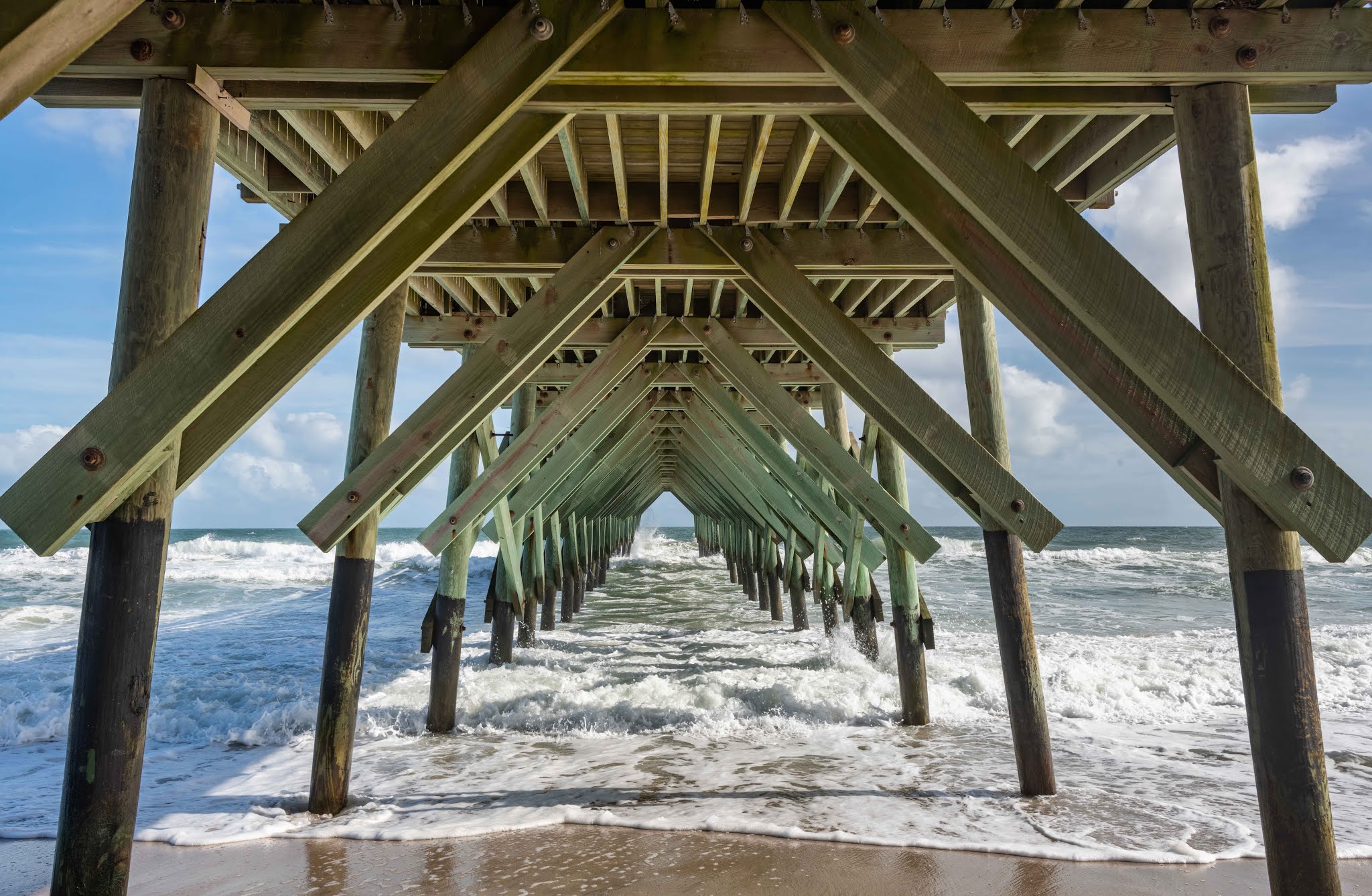
I personally have been enjoying taking low light photos around the piers and late this afternoon I went back to the large concrete fishing pier to try and capture some complementary shots to those I took yesterday morning at Crystal Pier. For photo competitions it’s often an advantage to have a set of images rather than just one shot and I’m starting to work towards a collection that might be called “Under the boardwalk”. 

Mike

34 12.383 N, 77 48.020 W


The fishing Pier - Wrightsville Beach


The fishing Pier - Wrightsville Beach


The fishing Pier - Wrightsville Beach


Later afternoon on Wrightsville Beach


Paddle Board in the surf - Wrightsville Beach


Monday, November 9, 2020

Grocery shopping the easy way

Grocery shopping the easy way

November 9, 2020

While some people slept late, Mike took the dinghy to shore to take photos.  He left the boat before first light.  I call that true devotion... I slept until it was fully light. Breakfast was a leisurely affair featuring homemade Irish soda bread.  After we had overeaten at the breakfast table, we rolled to shore in the dumb dog.  To check out Lyft (which had failed for Rod on his arrival in Norfolk) we ordered a car to take us to the Harris Tweeter grocery store. Once our shopping was accomplished a second Lyft car brought us, plus the giant bags of groceries, to the dinghy dock.  Wow, that was great!  The bonus is that now Rod is confident that he will be able to order a car to take him to the airport tomorrow.  

After a walk on the beach, we returned to the boat and watched porpoises (or were they dolphins?) swimming around the anchorage.  Eventually, we had to get ready to go out to dinner.  

We took the dinghy around to the ICW to have dinner at a place called the Bluewater Grill. Susan (Fran’s sister) who used to live in this area had given us the recommendation.  We tied up right below the deck where the outside dining area was.  The sun was just setting as we arrived, having opted for doing the journey in the daylight in one direction anyway.  We had a fabulous meal.  Rod and Mike shared an appetizer of Crab dip.  I had a salad for appetizer.  Then for main meals we had crab stuffed flounder, a seafood mixed grill and seafood linguini.  The food was excellent. (Thank you so much, Susan!)  The dinghy ride back was in full darkness but with smooth water and few navigational problems.  

Now we are back aboard feeling quite full and contemplating watching some of yesterday’s football games.  

Gloria

34 12.383 N, 77 48.020 W


Crystal Pier, Wrightsville Beach - at dawn - approximately 3 minute exposure with extra illumination of the pier by flashlight.  I was hoping for a great sunrise but that never materialized


Crystal Pier, Wrightsville Beach - shortly after dawn - the waves that were crashing on the beach disappear under the long exposure


Crystal Pier, Wrightsville Beach - early morning light - Black and white highlights the geometry of the structure


A dramatic rainbow photographed from cotinga at anchor


Wrightsville Beach on a perfect afternoon in November!


Sunday, November 8, 2020

A Lazy day … No Way!

A Lazy day … No Way! 

Sunday 8th November 2020

As I write this I’m hearing comments such as “I’m tired”, “my legs hurt … I’m a cyclist, not a walker”, “can I take a nap”? From this you might surmise that we took on a serious hike today. Well not exactly! We started the day with a leisurely cooked breakfast (quesadillas with eggs, bacon and green peppers) and then re-inflated the dinghy and went ashore. There’s a convenient dinghy dock about 2 minutes away from our anchorage that gives access to the barrier island part of Wrightsville Beach. We decided to take a walk along the beach, which was lovely. The weather was warm (low 70s F) and it was a beautiful sandy beach with excellent public access. There were lots of people sunbathing and a few swimmers and surfers. There seemed little chance of catching covid-19 with a 15-knot breeze off the ocean. When we reached Crystal Pier we stopped for lunch at Oceana, eating outside on the deck. Then we wandered along to the end of the barrier island to the Masonboro inlet where we had sailed in the previous afternoon. I have to say it looked quite spooky with lots of surf hitting the breakwaters. Of course when you get to the end you have to walk back and now we are all a bit tired. To be honest I think that has  more to do with the rigors of our sailing the day before than the walk we did today.

On the way back Rod and I did a “manly” job at the small grocery store near the dinghy dock. We picked up a variety of locally brewed cans of beer … and failed to get anything else on the list! Gloria asked if we had bought a loaf of bread … like for breakfast … err, no just beer. I felt so guilty that on returning to the boat I made a loaf of Irish soda bread (which is quick and easy). We’ll see how that turned out tomorrow. Overall I think it was a fairly lazy day but I don’t think Gloria and Rod would agree!

Mike

34 12.383 N, 77 48.020 W


Crystal Pier Wrightsville Beach


Wrightsville Beach from Crystal Pier


Gloria and Rod - Wrightsville Beach


Sanderling


The northern breakwater of the Masonboro Inlet - the breakwater actually protects the inlet better than it appears in this photo and it is a deep water entry - it's much safer than many of the other inlets on this section of coast. Yesterday we heard a discussion with the Coast Guard on the VHF radio involving an overturned vessel in the Carolina Beach inlet (a few miles south of here) in which 4 people ended up in the water and one of them unconscious.